The redistricting process in New York City can be opaque, leading to limited public participation in decisions that have a profound impact on communities across every borough. Citizens’ voting power, the quality of municipal services, public policy decisions, and more are all encompassed within district lines.
With the democratization of this critical process in mind, the CUNY Graduate Center has launched Redistricting & You: NYC, an interactive online map focused on the New York City Council districting processes. This data visualization project, supported by the Fund for the City of New York, charts the impact that district lines have on communities, and is modeled on the Graduate Center’s New York State tool.
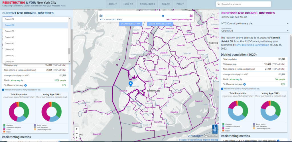
The NYC Districting Commission has published its first proposed City Council district plan as required by the NYC Charter after the 2020 Census and guided by state & federal legal requirements. The Redistricting & You: NYC displays the current proposed district lines.
A Simple Guide to “Redistricting & You”
District population & demographics
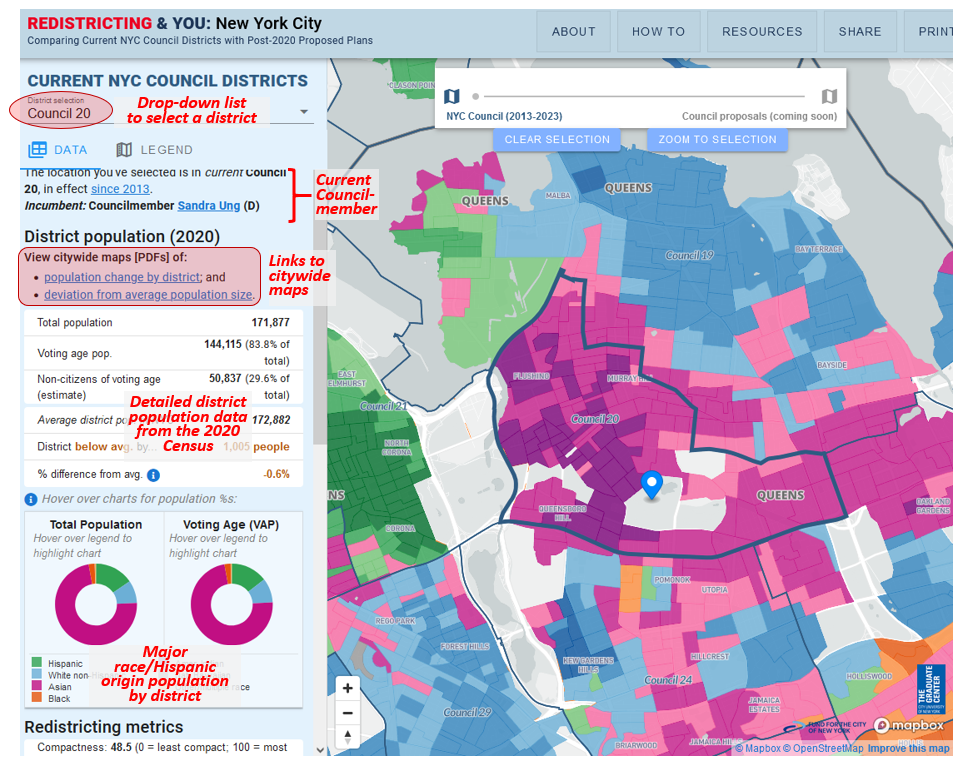
For each current Council district, Redistricting & You: NYC displays helpful information for stakeholders who want to learn more and participate in the districting process, such as:
* current councilmember’s name and party affiliation, with a link to the district’s profile at the NYC Council website;
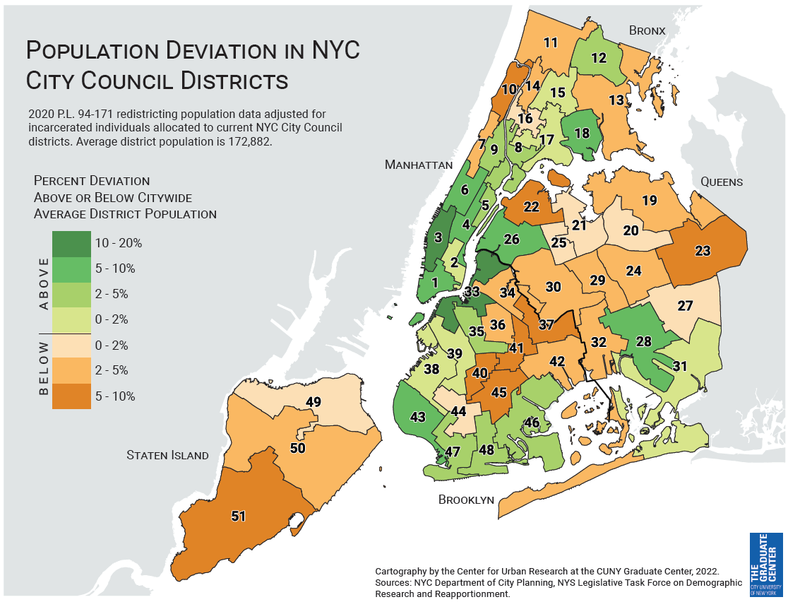
* district-level population data such as overall & voting age population (from the 2020 Census), estimated non-citizens of voting age (per the 2016-2020 American Community Survey), and deviation from average district population size;
* pie charts showing population distribution by race/Hispanic origin as indicated in the 2020 Census (for overall population and voting age population); and
* party enrollment and vote results from the 2021 general election for mayor, by council district.
The image below highlights each section of Redistricting & You: NYC where you can access this information.
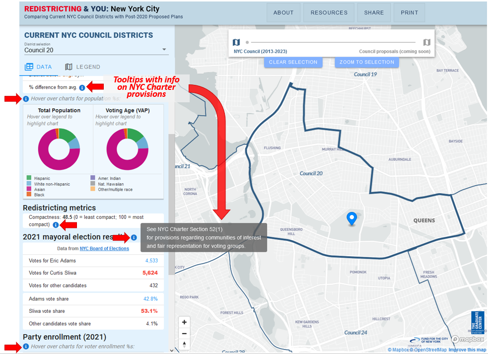
NYC Charter provisions highlighted on map
Each of the details in the side panel at Redistricting & You: NYC is related to one or more provisions of the NYC Charter that govern the city council districting process.
Specific Charter provisions are displayed when you move your mouse over each “info icon” in the side panel (see annotated screenshot below).
For example, the info icon in the Redistricting Metrics section reveals that Section 52(1)(d) of the Charter states that “Each district shall be compact and shall be no more than twice as long as it is wide.”
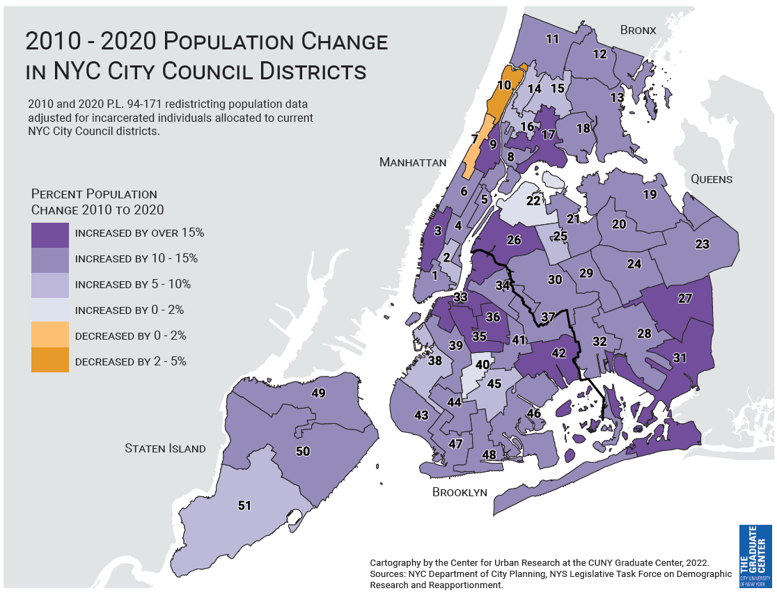
Citywide views of population change by district, & deviation from average district size
The maps below display citywide patterns by City Council district of population change between 2010 and 2020 (map on the left), and population deviation from the citywide average district size (map on right).
These patterns provide an initial indication of how current district lines may need to change to reflect the redistricting principle that districts should be as close to equal population as possible.
Send feedback
Please send any feedback or suggestions for making the maps more useful.